Press release

From March 2016 onwards, Dr. Markus Neteler, a prominent head of the Open Source GIS scene, will join the management board of mundialis GmbH & Co. KG in Bonn, Germany. Founded in 2015, mundialis combines remote sensing and satellite data analysis in the field of Big Data with Open Source WebGIS solutions.

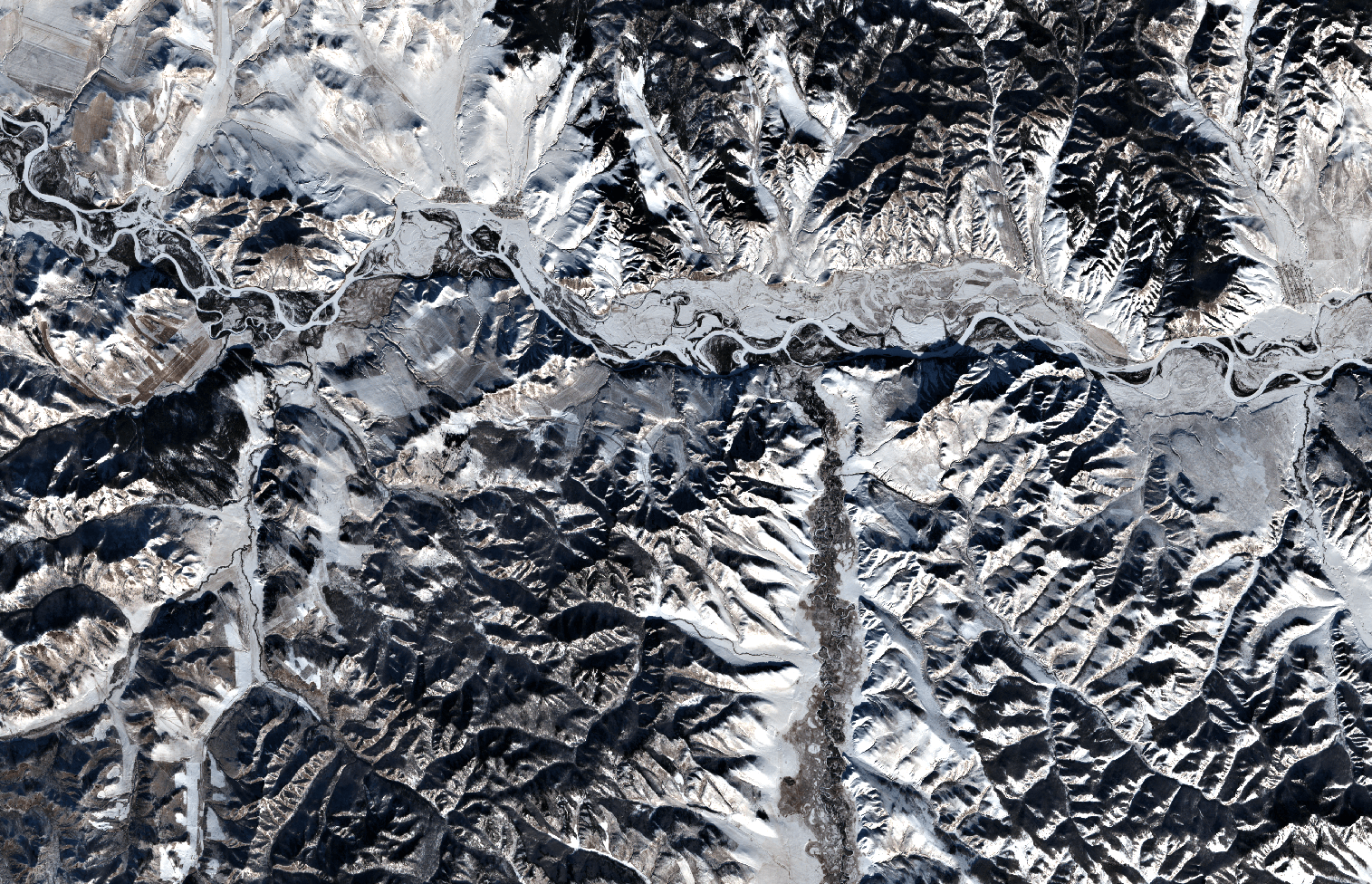
Since 2008, Dr. Neteler was the head of the GIS and remote sensing unit at the Edmund Mach Foundation in Trento (Italy) and worked in this capacity on numerous projects related to biodiversity, environmental and agricultural research. He is also a founding member of the Open Source Geospatial Foundation (OSGeo), a nonprofit organization with headquarters in Delaware (USA), that promotes the development and use of free and open source geographic information systems (GIS). Since 1998 he coordinated the development of the well known GRASS GIS software project, a powerful Open Source GIS that supports processing of time series of several thousand raster, 3D raster or vector maps in a short time. Mongolia as seen by Sentinel-2A
Markus will keep his role as “Mr. GRASS” at mundialis, especially because the company also sees itself as a research and development enterprise that puts its focus on the open source interfaces between geoinformation and remote sensing. Although a new company, mundialis offers more than 50 years of experience in GIS, due to the background of its management. Besides Neteler, there are Till Adams and Hinrich Paulsen, both at the same time the founders and CEOs of terrestris in Bonn, a company that develops Open Source GIS solutions since 2002. These many years of experience in the construction of WebGIS and Geoportal architectures using free software as well as in the application of common OGC standards – are now combined with mundialis’ expertise in the processing of big data with spatial reference and remote sensing data.

Contact: https://www.mundialis.de/

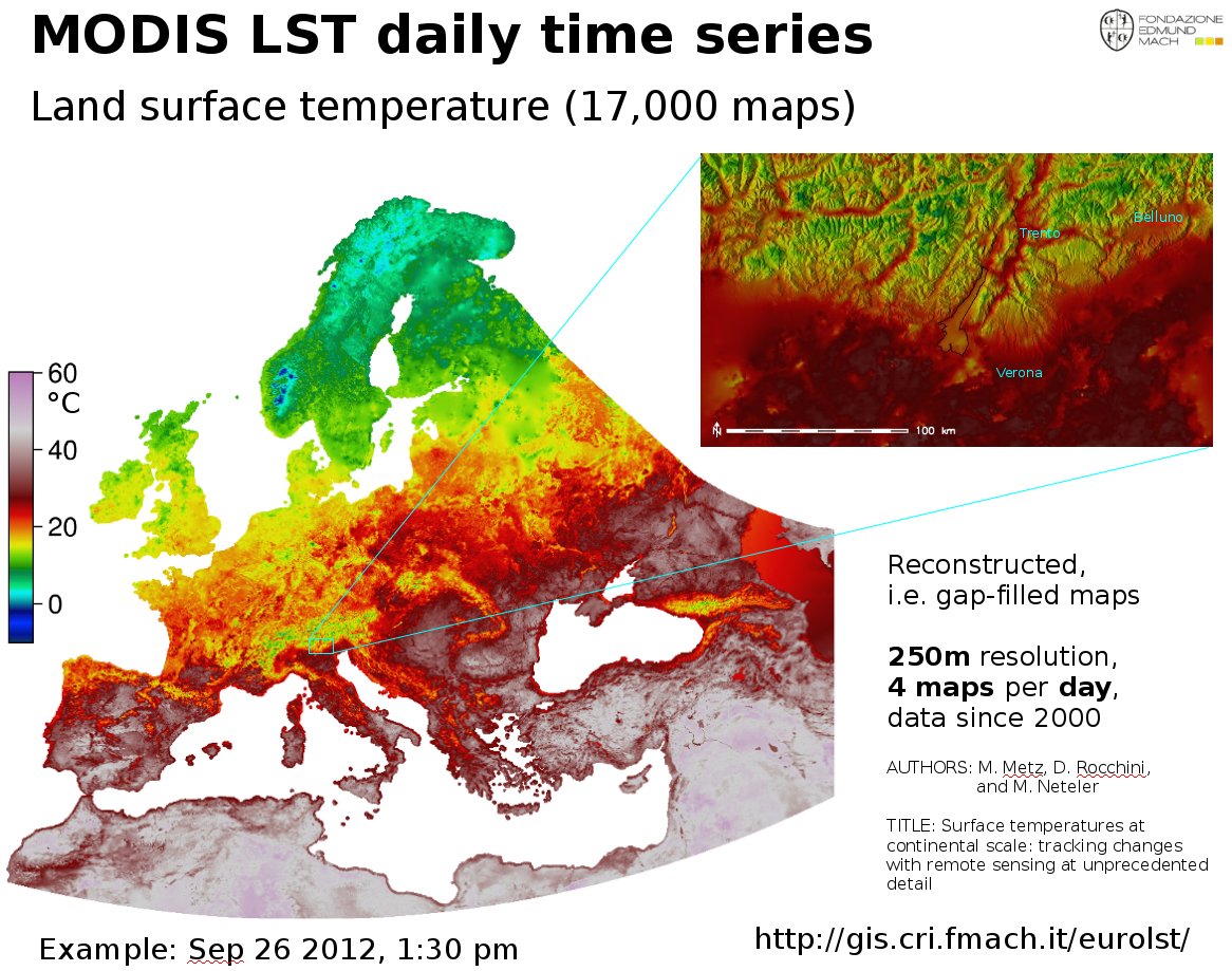
The EuroLST dataset is seamless and gap-free with a temporal resolution of four records per day and enhanced spatial resolution of 250 m. This newly developed reconstruction method (Metz et al, 2014) has been applied to Europe and neighbouring countries, resulting in complete daily coverage from 2001 onwards. To our knowledge, this new reconstructed LST time series exceeds the level of detail of comparable reconstructed LST datasets by several orders of magnitude. Studies on emerging diseases, parasite risk assessment and temperature anomalies can now be performed on the continental scale, maintaining high spatial and temporal detail. In their paper, the authors provide examples for implications and applications of the new LST dataset, such as disease risk assessment, epidemiology, environmental monitoring, and temperature anomalies.

Reconstructed MODIS Land Surface Temperature Dataset, at 250m pixel resolution (click figure to enlarge):

MODIS Land Surface Temperature (LST) time series reconstructed

MODIS Land Surface Temperature (LST) reconstructed (gap-filled)

Article and data citation:

EuroLST has been produced by the former PGIS group at Fondazione Edmund Mach, DBEM based on daily MODIS LST (Product of NASA) maps.

Metz, M.; Rocchini, D.; Neteler, M. 2014: Surface temperatures at the continental scale: Tracking changes with remote sensing at unprecedented detail. Remote Sensing. 2014, 6(5): 3822-3840 (DOI | HTML | PDF)

Used software

Open Source commands used in processing (GRASS GIS 7):
links to the related manual pages involved in the data preparation

  • i.pca: Principal Components Analysis (PCA) for image processing.
  • r.regression.multi: it calculates multiple linear regression from raster maps
  • v.surf.bspline: it performs bicubic or bilinear spline interpolation with Tykhonov regularization.

Furthermore:

  • r.bioclim: calculates various bioclimatic indices from monthly temperature and optional precipitation time series (install in GRASS GIS 7 with “g.extention r.bioclim”)
  • pyModis: Free and Open Source Python based library to work with MODIS data

Metadata

Map projection: EPSG 3035, prj file
PROJCS["Lambert Azimuthal Equal Area",
    GEOGCS["grs80",
        DATUM["European_Terrestrial_Reference_System_1989",
            SPHEROID["Geodetic_Reference_System_1980",6378137,298.257222101]],
        PRIMEM["Greenwich",0],
        UNIT["degree",0.0174532925199433]],
    PROJECTION["Lambert_Azimuthal_Equal_Area"],
    PARAMETER["latitude_of_center",52],
    PARAMETER["longitude_of_center",10],
    PARAMETER["false_easting",4321000],
    PARAMETER["false_northing",3210000],
    UNIT["Meter",1]]

Selected open data derived from EuroLST

BIOCLIM derived from reconstructed MODIS LST at 250m pixel resolution

BIO1: Annual mean temperature (°C*10) BIO2: Mean diurnal range (Mean monthly (max - min tem)) BIO3: Isothermality ((bio2/bio7)*100) BIO4: Temperature seasonality (standard deviation * 100) BIO5: Maximum temperature of the warmest month (°C*10) BIO6: Minimum temperature of the coldest month (°C*10) BIO7: Temperature annual range (bio5 - bio6) (°C*10) BIO10: Mean temperature of the warmest quarter (°C*10) BIO11: Mean temperature of the coldest quarter (°C*10)

BIOCLIM-like European LST maps following the “Bioclim” definition (Hutchinson et al., 2009) – derived from 10 years of reconstructed MODIS LST (download to be completed) as GeoTIFF files, 250m pixel resolution, in EU LAEA projection:

Each ZIP file contains the respective GeoTIFF file (for cell value units, see below), the color table as separate ASCII file and a README.txt with details.

WMS/WCS Server

Using this URL, you can read the EuroLST BIOCLIM data directly via OGC WMS and WCS protocol:

https://web.archive.org/web/20220615191155/https://geodati.fmach.it/production/ows_europe_lst

OpenData License

The data published in this page are open data and released under the ODbL (Open Database License).

The full EuroLST dataset is not released online as open data (size: 18TB), please ask Luca Delucchi or Roberto Zorer for more info


Acknowledgments

The MOD11A1.005, MYD11A1.005 were retrieved from the online web site, courtesy of the NASA EOSDIS Land Processes Distributed Active Archive Center (LP DAAC), USGS/Earth Resources Observation and Science (EROS) Center, Sioux Falls, South Dakota, https://e4ftl01.cr.usgs.gov/

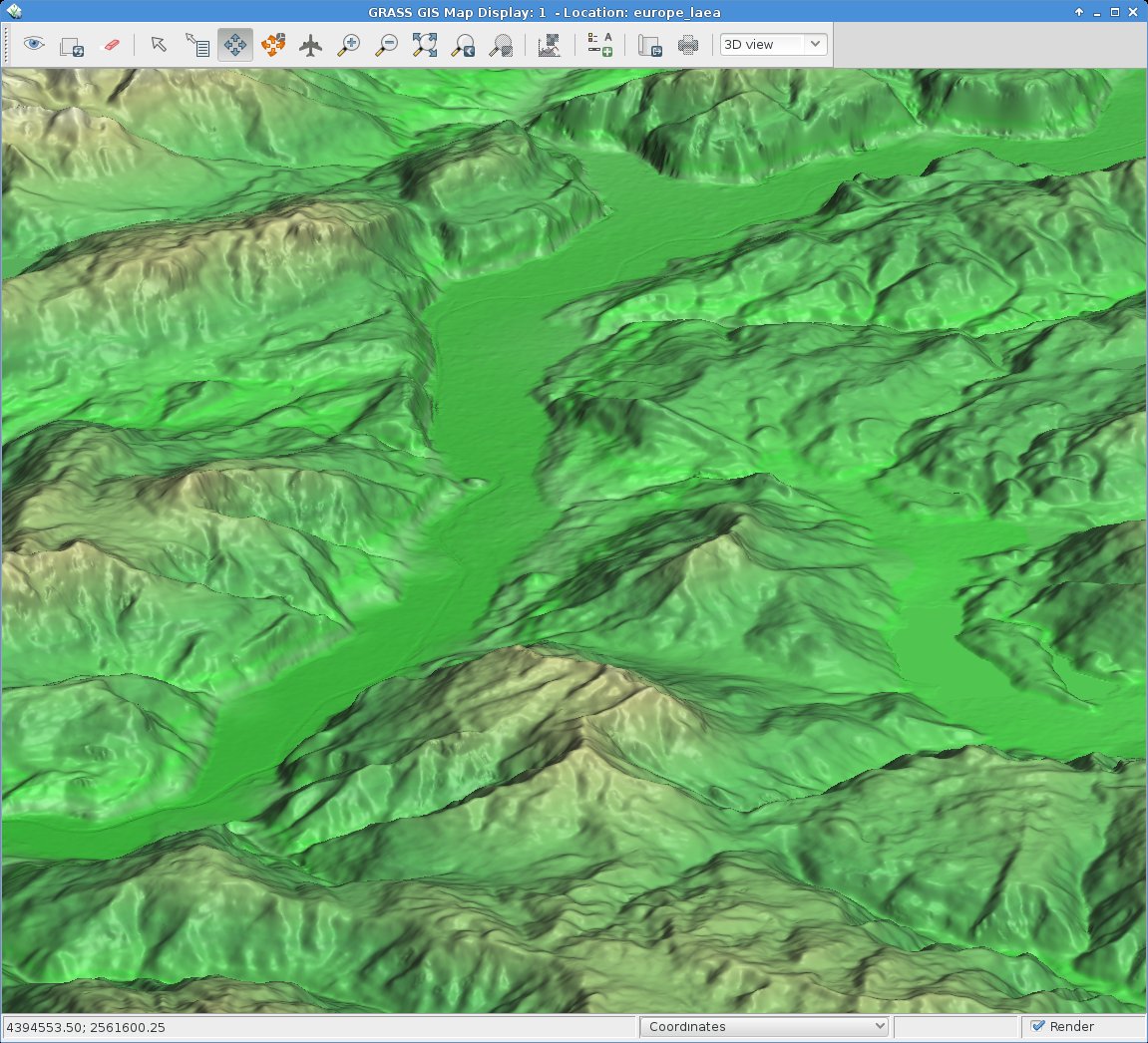
eu_dem_upper_garda_lake_riva_arco_italy

EU DEM 25m upper Garda Lake area with Riva del Garda and Arco (Italy). 3D view in wxNVIZ – GRASS GIS 7

The 25m European Digital Elevation Model (EU-DEM, Version 1) is a Digital Surface Model (DSM) representing the first surface as illuminated by the sensors:

eu_dem_s_michele_rotaliana_italy

EU DEM Rotaliana with Mezzocorona and S. Michele (Italy). Produced using Copernicus data and information funded by the European Union – EU-DEM layers.

Its elevations were captured at 1 arc second postings (2.78E-4 degrees). The tiles are provided at 25m resolution in EU-LAEA (EPSG. 3035) projection, temporal coverage: 2000, published in Oct 2013. It is a realisation of the Copernicus programme, managed by the European Commission, DG Enterprise and Industry. Metadata are provided here. According to their “Methodology” page it is a hybrid product based on SRTM and ASTER GDEM data fused by a weighted averaging approach and it has been generated as a contiguous dataset divided into 1 degree by 1 degree tiles, corresponding to the SRTM naming convention. In addition to the DEM data, a colour shaded relief image over Europe is provided.

From the metadata page: “The EU-DEM data are provided as is, i.e. without a formal validation yet. An independent statistical validation is scheduled as part of the GIO land monitoring service activities, and will be made available in the course of 2014.

Data download

Note that the GeoTIFF files are of major size, up to 5 GB:

Data import

The data come as ZIP compressed files, hence unzipping occurs (or simply use the fancy “vsizip” driver in GDAL).

Hint for GRASS GIS users: instead of importing the data, you can use the r.external command to register the GeoTIFF DEM file instead of imorting it within a EU LAEA projected location.

Enjoy!

eu_dem_trento_adige_s_michele_italy

We are pleased to announce that the 50th ICA-OSGeo Lab has been established at the GIS and Remote Sensing Unit (Piattaforma GIS & Remote Sensing, PGIS), Research and Innovation Centre (CRI), Fondazione Edmund Mach (FEM), Italy. CRI is a multifaceted research organization established in 2008 under the umbrella of FEM, a private research foundation funded by the government of Autonomous Province of Trento. CRI focuses on studies and innovations in the fields of agriculture, nutrition, and environment, with the aim to generate new sharing knowledge and to contribute to economic growth, social development and the overall improvement of quality of life.

The mission of the PGIS unit is to develop and provide multi-scale approaches for the description of 2-, 3- and 4-dimensional biological systems and processes. Core activities of the unit include acquisition, processing and validation of geo-physical, ecological and spatial datasets collected within various research projects and monitoring activities, along with advanced scientific analysis and data management. These studies involve multi-decadal change analysis of various ecological and physical parameters from continental to landscape level using satellite imagery and other climatic layers. The lab focuses on the geostatistical analysis of such information layers, the creation and processing of indicators, and the production of ecological, landscape genetics, eco-epidemiological and physiological models. The team pursues actively the development of innovative methods and their implementation in a GIS framework including the time series analysis of proximal and remote sensing data.

The GIS and Remote Sensing Unit (PGIS) members strongly support the peer reviewed approach of Free and Open Source software development which is perfectly in line with academic research. PGIS contributes extensively to the open source software development in geospatial (main contributors to GRASS GIS), often collaborating with various other developers and researchers around the globe. In the new ICA-OSGeo lab at FEM international PhD students, university students and trainees are present.

PGIS is focused on knowledge dissemination of open source tools through a series of courses designed for specific user requirement (schools, universities, research institutes), blogs, workshops and conferences. Their recent publication in Trends in Ecology and Evolution underlines the need on using Free and Open Source Software (FOSS) for completely open science. Dr. Markus Neteler, who is leading the group since its formation, has two decades of experience in developing and promoting open source GIS software. Being founding member of the Open Source Geospatial Foundation (OSGeo.org, USA), he served on its board of directors from 2006-2011. Luca Delucchi, focal point and responsible person for the new ICA-OSGeo Lab is member of the board of directors of the Associazione Italiana per l’Informazione Geografica Libera (GFOSS.it, the Italian Local Chapter of OSGeo). He contributes to several Free and Open Source software and open data projects as developer and trainer.

Details about the GIS and Remote Sensing Unit at https://gis.cri.fmach.it/

Open Source Geospatial Foundation (OSGeo) is a not-for-profit organisation founded in 2006 whose mission is to support and promote the collaborative development of open source geospatial technologies and data.

International Cartographic Association (ICA) is the world authoritative body for cartography and GIScience. See also the new ICA-OSGeo Labs website.

In my presentation I briefly review 3 decades of Open Source GIS development, from the 1980th to the present.

See my slides:

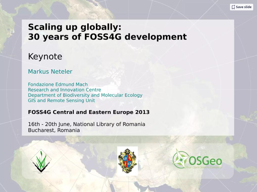
Scaling up globally: 30 years of FOSS4G development. Keynote at FOSS4G-CEE 2013, Romania by Markus Neteler


Presentation file: Download presentation file (ODP) to get all the clickable links working!

Join us at FOSS4G Central and Eastern Europe (FOSS4G-CEE) 2013 from 16th – 20th June, National Library of Romania, Bucharest, Romania.

You will meet well known Keynote Speakers (random order): Jeff McKenna, Paul C. Smits, Jáchym Čepický, Schuyler Erle, Maria Antonia Brovelli, Dirk Frigne, Markus Neteler, Alyssa Wright, and Radu Puchiu.

Check the long list of Practical Workshops and Oral Presentations at: https://2013.foss4g-cee.org/program/schedule
Check out for the additional Code Sprint, the Open GeoData Hackathon, and the Open Data Side Event.

How to arrive? See https://2013.foss4g-cee.org/venue/map

To my surprise I found an announcement from last week, that the “European Soil Databases” (ESDB) are freely available to the public. In the light of the new INSPIRE directive, the combination of freely & public for European data will apparently remain rare. Of course we are talking free beer/lunch here since “The data are made available for research purposes only and not for any other activity […] The permission to use … under no circumstances are these data passed to third parties.” and so forth. I feel that our taxpayers money was used to prepare these data.

How to obtain the “European Soil Databases”? You have to send a MS-Word (!) document to them to register. This file opens with a little layout mess in OpenOffice. When will they switch to open document formats (read: ASCII for this purpose or HTML form)? But we should not complain too much of course. Just submitted, let’s wait for the non-free (in the sense of freedom) data now…

Impressive: the European petition on public geodata will reach 6500 verified signatures the next days! In total, more than 8000 signatures were already collected… BTW: Did YOU sign?

Vote for Public Maps - Reject INSPIRE!

I get the impression that the Web sites where Soviet Military Topographic Map Sets are collected, slowly disappear from the web. I wonder, if OSGeo.org could give these really nice maps a new home. I found some remaining material on the web:

Map coverage (latest?):
* https://replay.waybackmachine.org/20060523215417/https://library.ucsc.edu/maps/ucsmg/soviet.jpg

Some links:

Soviet Topographic Map Symbols

Edit 2015: Interesting write-up by Wired about the maps: