The beautiful days in early November 2014 allowed to get some nice views of the Trentino (Northern Italy) – thanks to Landsat 8 and NASA’s open data policy:

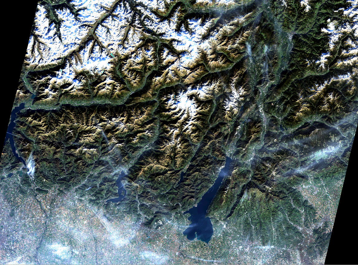
Landsat 8: Northern Italy 1 Nov 2014

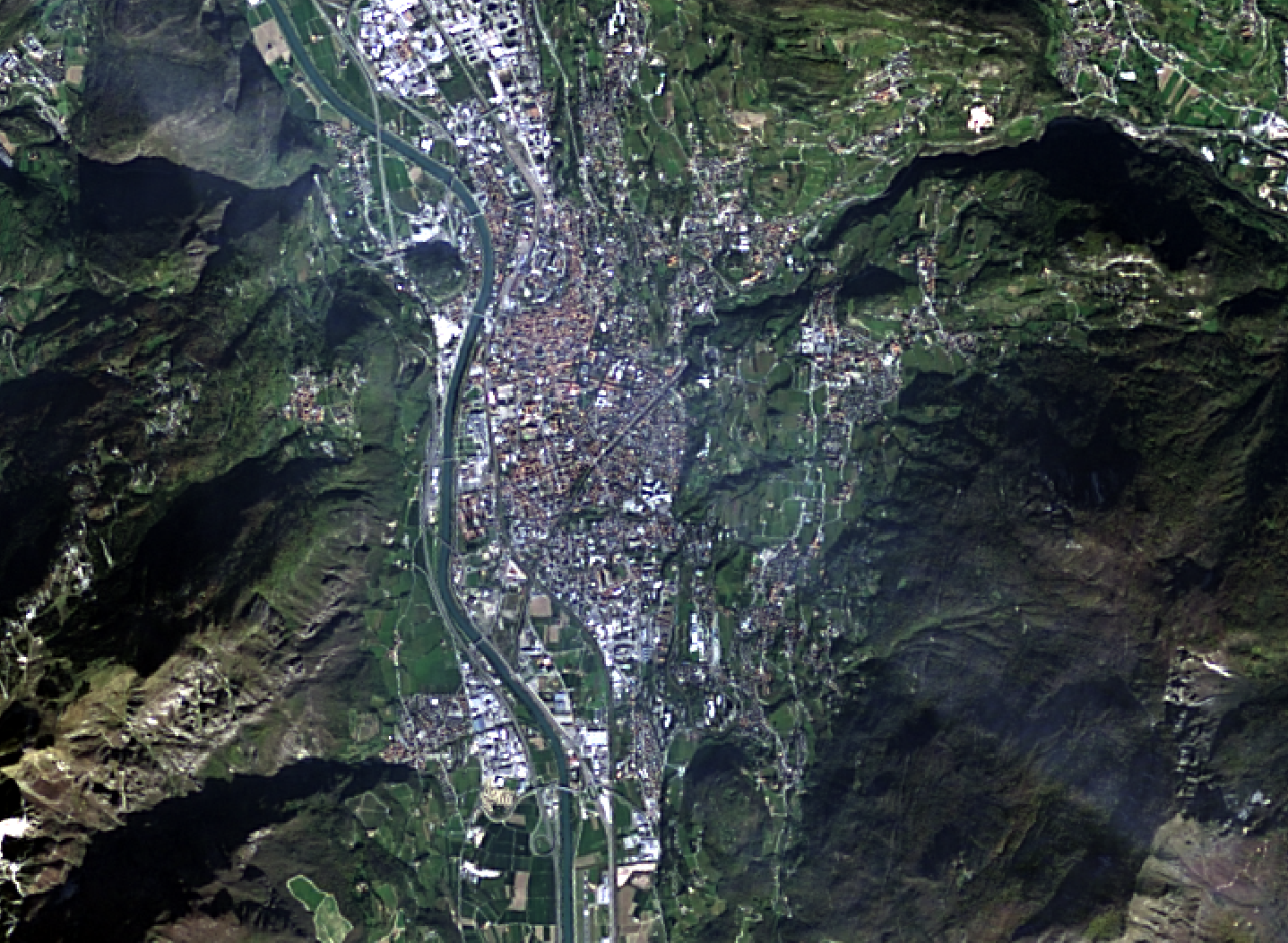
Trento captured by Landsat8

Landsat 8: San Michele - 1 Nov 2014
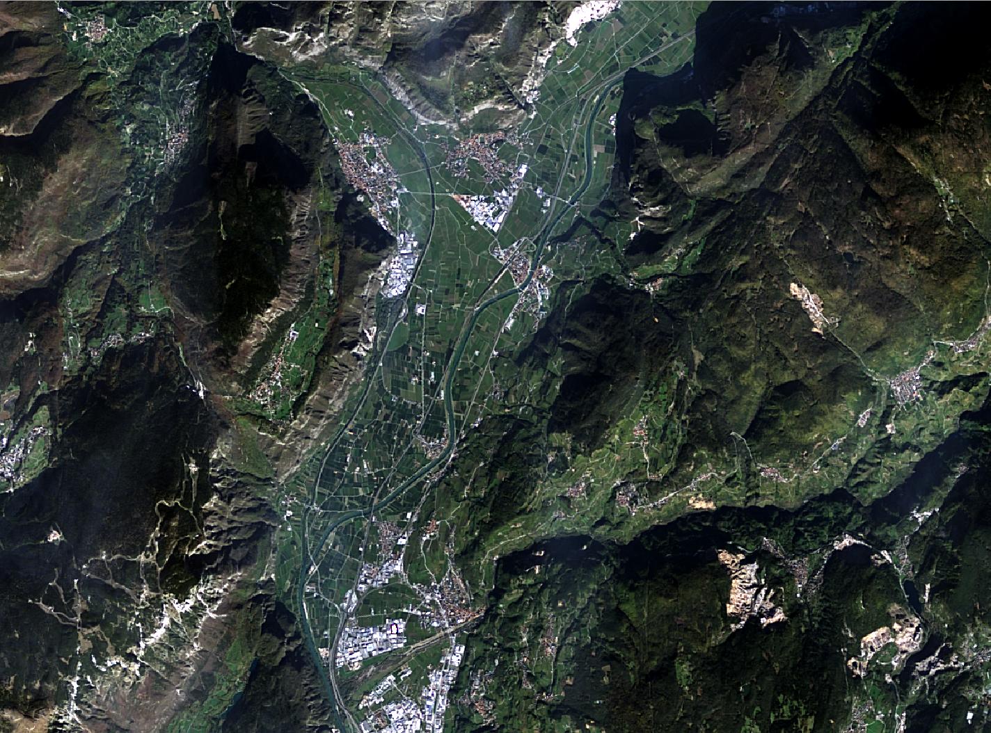
Landsat 8: San Michele – 1 Nov 2014

The beauty of the landscape but also the human impact (landscape and condensation trails of airplanes) are clearly visible.

All data were processed in GRASS GIS 7 and pansharpened with i.fusion.hpf written by Nikos Alexandris.

In the new release of QGIS 2.6.0 a series of new features have been added concerning

  • General: new features and bugfixes,
  • DXF export (improvements),
  • Map Composer (enhancements),
  • Processing (including a new modeler implementation),
  • QGIS Server (improvements),
  • Symbology (including user interface improvements),
  • User Interface with improvements.

A visual changelog is available for more details with lots of screenshots.

Congratulations to all QGIS developers! Looking forward to see the Fedora RPM available…

You can download QGIS 2.6 at https://qgis.org/en/site/forusers/download.html