The GRASS GIS community is delighted to present the outcome of the 4th Community Sprint that took place in a warm and sunny Prague, Czech Republic, from July 12 to July 18, 2013. The event happened after the Geoinformatics conference at the Czech Technical University in Prague. The Community Sprint was once more a creative gathering of both long-term and new developers, as well as users.
This meeting was held in the light of 30 YEARS OF GRASS GIS!

30 YEARS OF GRASS GIS!
We wish to cordially thank the Department of Mapping and Cartography, Faculty of Civil Engineering, Czech Technical University in Prague for hosting and technical support. In particular, we gratefully acknowledge our association sponsors OSGeo  and FOSSGIS e.V., and many individual donors: Peter Löwe, Andrea Borruso, Massimo Di Stefano, Alessandro Sarretta, Joshua Campbell, Andreas Neumann, Jon Eiriksson, Luca Casagrande, Karyn O Newcomb, Holger Naumann, Anne Ghisla, Helena Mitasova and Lubos Mitas, Dimitris Tamp, Mark Seibel, Markus Metz, and Tawny Gapinski. These financial contributions were used to cover costs such as meals and to help reducing travelling and accommodation expenses for participants with far arrival who came on own expenses.

Developers and users who joined the event came from various countries like Italy, Czech Republic, Slovak Republic, Poland, Sri Lanka/France, USA and Germany.
The Community Sprint focused on:

  • testing/bugfixing of the upcoming GRASS 7 version,
  • backporting new functionalities to the stable GRASS 6.4 series,
  • testing/bugfixing related to Mac OS X, MS-Windows and Linux,
  • presenting and developing the new Temporal GIS Algebra in GRASS 7,
  • connecting GRASS 7 with the planetary science software ISIS,
  • discussing integration with rasdaman.org software, a powerful multidimensional raster processor,
  • creating 3D vector test data for 3D interpolation,
  • discussing vector conflation,
  • discussing Bundle Block Adjustments,
  • presenting the state of image processing in GRASS 7, and discussing its future,
  • improving documentation, with focus on image processing and Temporal GIS Algebra,
  • developing/refactoring and bugfixing several wxGUI’s components,
  • further developing customizable wxGUI Toolboxes concept,
  • improving translation in Polish and Romanian languages,
  • fixing v.krige in GRASS7 and proposing merge with the recently developed v.kriging module,
  • meeting between Google Summer of Code 2013 mentor and students.

A lot of topic oriented discussions happened among small groups of participants: for more detailed information, please visit the Wiki pages at https://grasswiki.osgeo.org/wiki/GRASS_Community_Sprint_Prague_2013 and the related discussion page at https://grasswiki.osgeo.org/wiki/Talk:GRASS_Community_Sprint_Prague_2013

About GRASS GIS
The Geographic Resources Analysis Support System, commonly referred to as GRASS GIS, is an Open Source Geographic Information System providing powerful raster, vector and geospatial processing capabilities in a single integrated software suite. GRASS GIS includes tools for spatial modeling, visualization of raster and vector data, management and analysis of geospatial data, and the processing of satellite and aerial  imagery. It also provides the capability to produce sophisticated presentation graphics and hardcopy maps. GRASS GIS has been translated into about twenty languages and supports a huge array of data formats. It is distributed freely under the terms of the GNU General Public License (GPL). GRASS GIS is an official project of the Open Source Geospatial Foundation (OSGeo).

GRASS GIS Development Team, July 2013

GRASS GIS 6.4.3 released – Birthday release for 30 years of GRASS GIS
https://grass.osgeo.org

30 YEARS OF GRASS GIS!

We are pleased to announce the release of a new stable version of GRASS GIS. This release fixes bugs discovered in 6.4.2 version of the program and adds a number of new features. This release includes over
830 updates to the source code since 6.4.2. As a stable release series, the 6.4 line will enjoy long-term support and incremental enhancements while preserving backwards-compatibility with the entire GRASS 6 line.

Key improvements of this release include some new functionality (assistance for topologically unclean vector data), major speedup for some vector modules, fixes in the vector network modules, fixes for the wxPython based portable graphical interface (attribute table management, wxNVIZ, and Cartographic Composer). A number of new modules have been added for processing LANDSAT and MODIS satellite data, and a new vector statistics module is also introduced. Many new symbols and north arrows are available, and the user will find an improved and easier to use wizard for creating custom project locations with precise map projection and datum support. Community-contributed add-on modules are now more easily and robustly installed from an online archive. Other major developments include enhancements to the Python scripting library and numerous software-compatibility fixes and translation updates. Important is the enhanced portability for MS-Windows (native support, fixes in case of missing system DLLs). And we welcome Romanian as our twenty-fourth language!

Source code download:

Binaries download:

  • … further packages will follow shortly.

To get the GRASS GIS 6.4.3 source code directly from SVN:
svn checkout https://svn.osgeo.org/grass/grass/tags/release_20130727_grass_6_4_3/

See also our detailed announcement:

https://trac.osgeo.org/grass/wiki/Release/6.4.3-News

First time users should explore the first steps tutorial after installation.

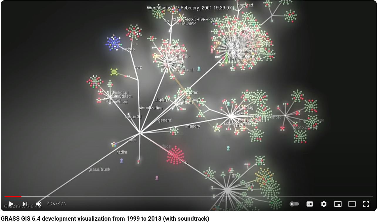
Video of GRASS GIS 6.4 development visualization from 1999 to 2013 (with soundtrack)

GRASS GIS 6.4 development visualization from 1999 to 2013 (with soundtrack)

About GRASS GIS

GRASS (Geographic Resources Analysis Support System) is a free and open source Geographic Information System (GIS) software suite used for geospatial data management and analysis, image processing, graphics and map production, spatial modeling, and 3D visualization. GRASS GIS is currently used in academic and commercial settings around the world, as well as by many governmental agencies and environmental consulting companies. GRASS GIS can be used either as a stand-alone application or as backend for other software packages such as QGIS and R geostatistics. It is a founding member of the Open Source Geospatial Foundation (OSGeo).

Fourth (and last) release candidate of GRASS GIS 6.4.3 with improvements and stability fixes
A fourth release candidate of GRASS GIS 6.4.3 is now available.

Source code download:

Binaries download:

To get the GRASS GIS 6.4.3RC4 source code directly from SVN:
 svn checkout https://svn.osgeo.org/grass/grass/tags/release_20130710_grass_6_4_3RC4/

Key improvements of this release include some new functionality (assistance for topologically unclean vector data), fixes in the vector network modules, fixes for the wxPython based portable graphical interface (attribute table management, wxNVIZ, and Cartographic Composer), fixes in the location wizard for Datum transform selection and support for PROJ.4 version 4.8.0, improvements for selecting the Python version to be used, enhanced portability for MS-Windows (native support, fixes in case of missing system DLLs), and more translations (esp. Romanian).

See also our detailed announcement:
 https://trac.osgeo.org/grass/wiki/Release/6.4.3RC4-News

First time users should explore the first steps tutorial after installation.

Release candidate management at
https://trac.osgeo.org/grass/wiki/Grass6Planning

Please join us in testing this release candidate for the final release.

Consider to donate pizza or beer for the upcoming GRASS GIS Community Sprint in Prague:
Thanks to all contributors!
Have you been using GRASS GIS within your company or for your daily tasks? Would like to express your satisfaction and give something back to these terrific software developers to make them even happier during the July’s GRASS GIS Community Sprint in Prague?
Sure – so don’t think twice and support the developers with a (micro)donation!
Please contact Markus Neteler (neteler@osgeo.org – GRASS GIS PSC Chair) for further details.
Wait – it is also possible to buy a round of beer for the developers with a quick click using the PayPal “Buy [pizza/beer/…] Now” button below: (… more pizza & beer for the developers)

About the Community Sprint

A “Community Sprint” is a get-together for members and supporters of GRASS GIS and related OSGeo projects to make decisions and tackle larger problems. Developers and contributors are donating their valuable time, so appreciate direct or in-kind funding made available for the sprint meeting to cover out-of-pocket expenses. All of the work that takes place at the community sprint will be directly contributed back into the GRASS GIS project to the benefit of everyone who uses it.
See the outstanding results from 2011, and 2012!