GRASS GIS 8.4.0 released
The GRASS GIS 8.4.0 release contains more than 520 changes compared to 8.3.2. This new minor release includes important fixes and improvements to the GRASS GIS tools, libraries and the graphical user interface (GUI), making it even more stable and robust for daily work.
Highlights
Most importantly: location becomes project: The Python API, command line, and graphical user interface are now using project instead of location for the main component of the data hiearchy while maintaining backward compatibility.
Further relevant changes:
- Python: the creation of new projects in Python has been greatly simplified (no more chicken and egg problems) – also for Jupyter notebooks.
- GUI: easy command history navigation through the new History browser panel.
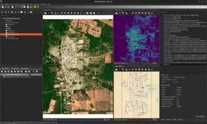
- GUI: Further improvements of new single-window GUI with undockable map display window, for a smoother user experience
- New GRASS GIS Programming Style Guide.
- For r.univar, the computation extended statistics is now parallelized.
- JSON output format support (
format="json") in multiple tools (e.g., r.report, r.info, v.db.select, t.rast.list, etc.) - A new support vector machine image classification (SVM) has been added in i.svm.
- v.fill.holes: New tool to remove inner isles and to keep outer boundary only
- ipyleaflet integration for grass.jupyter to create a map in ipyleaflet and add GRASS data in a single line
New Addon Tools
- i.eodag: Downloads imagery datasets from various providers through the EODAG API.
- r.flowaccumulation: Calculates flow accumulation from a flow direction raster map using the Memory-Efficient Flow Accumulation (MEFA) parallel algorithm by Cho (2023).
- r.fusion: image fusion, generalized pan-sharpening.
- r.maxent.train & r.maxent.predict: train, and predict a Maxent model to create a suitability distribution layer.
- r.windfetch: addon for computing wind fetch.
Thanks to all contributors!

 Follow
 Follow
