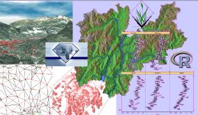
The participants will learn how to use GRASS 5.7, how to define own locations for various projections, analyse and correct external spatial data (GeoTIFF, SHAPE etc), how to do image geocoding and classification, how to derive parameters from elevation models and do statistical analysis in R with data directly read from GRASS and PostgreSQL. The slides will be made available printed.
| Session | Topics | Required Software | Required Datasets | Recommended Reading | Session Notes |
| Session 1: Intro | Intro Free Software, GRASS web site: where to download, docs, mailing lists etc, Intro KDE, shell commands, download "spearfish" + install, Using GRASS 5.7 with Spearfish location, 'd.m' (display manager) with raster + vector maps, NVIZ |
Have GRASS 5.7 installed |
Install sample data set SPEARFISH data set (9.7MB size, UTM projection, Clarke66 ellipsoid, NAD27 conus) | Have an idea about GIS; read this GRASS General Info page |
Notes 1 |
| Session 2: Proj. + GRASS Locations | Introduction to Projections and coordinate systems, general intro cylindrical, conic, azimuthal projections, what's Lat/Long, what's UTM, what's Gauss-Boaga, Geodetic Datum definition, use of 'cs2cs' (for points) + EPGS table, defining GRASS location (all 3 LL, UTM, GB), verification with 'g.region -l', import of vector map into Lat/Long, reprojection to UTM and GB | Have PROJ4 installed with 'cs2cs' program (as it is already a requirement for installing GRASS 5.7, so it should be already done). | Please also copy: | Take a look at the PROJ web sites (see at page bottom) | Notes 2 |
| Session 3: GDAL/OGR/Import | Raster management tools: gdalinfo + gdal_translate, Vector management tools: ogrinfo + ogr2ogr, Raster reprojection: gdalwarp, Vector reprojection: ogr2ogr, GRASS/Raster import: r.in.gdal, GRASS/vector import: v.in.ogr, import of own data into GRASS (supervised), Intro GRASS 5.7 vector data and DBMS | Have GDAL/OGR installed which provides 'gdalinfo', 'gdal_translate', 'gdalwarp[test]', 'ogrinfo', 'ogr2ogr' and more (as it is already a requirement for installing GRASS 5.7, it should be present in the system). | Please also copy: | Remember the differences between the various GIS
formats Read Chapter 3 of the GRASS 5.0 online tutorial |
Notes 3 |
| Session 4: Image Proc. | Spearfish location, Import LANDSAT (from GLCF Maryland), Import aerial DOQ (already downloaded) - reprojection/rectification; - vector digitizing; - classification with i.smap (supervised); - reports on results; - image fusion with Brovey; - using temperature LANDSAT channel | - |
|
GRASS Book: Chapter 10 + 11 or your preferred image processing book (e.g. Schowengerdt) | Import of LANDSAT-7 data |
| Session 5: DEM Proc. | raster map color tables, first order derivates: slope + aspect, second order derivates: curvatures + features, flow tracing, map algebra (r.mapcalc), cost surfaces, interpolation with RST (tips 'n tricks), Application: small project | - | - | GRASS Book: Chapter 5 | Notes 5 |
| Session 6: GRASS/R/PostgreSQL | Intro to R-stats, Intro to PostgreSQL, GRASS/R interface, Rdbi interface (R-PostgreSQL), reading raster maps from GRASS into R, exchanging data between PostgreSQL and R, lattice for nice plots, Application: LANDSAT-7 surf. temperature map vs. elevation | install notes session 6 | - | GRASS Book: Chapter 13 (R section) and/or the R book of P. Dalgaard and the Bruce Momjian PostgreSQL book (see below) |
Notes 6 Notes 7 |