 OSM Map
LongLat: 11.13736E, 46.19352N
 OSM Map
LongLat: 11.13736E, 46.19352N |
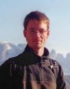
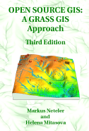
| Markus Neteler received his MSc degree in Physical Geography and Landscape Ecology from the University of Hanover in Germany in 1999. He worked at the Institute of Geography as Research Scientist and teaching associate for two years. From 2001-2007, he was a researcher at FBK-irst (formerly ITC-irst), from 2005-2007 also at Centro di Ecologia Alpina. Since 2008 he is employed at Fondazione Mach, Trento, Italy. His main research interests are remote sensing for environmental risk assessment and Free Software GIS development. He is author/co-author of two books on the Open Source Geographical Information System GRASS and various papers on applications in GIS. He is founding-member of GRASS Anwender-Vereinigung e.V. and the Open Source Geospatial Foundation (OSGeo.org). In September 2006, he was honored with the Sol Katz Award for Geospatial Free and Open Source Software (GFOSS). In 2010, he earned the degree of a Doctor of Natural Science (Dr. rer.nat) in Physical Geography. Markus Neteler is head of the GIS and Remote Sensing Unit at Fondazione Edmund Mach. |

|
Referee for International Journal of Geoinformatics, Ecology and Society, Agrometeorologia, International Journal of Geographical Information Science, Remote Sensing, ..., and member of the scientific board of various conferences.
Selected projects: For a more complete list, see the web site of my PGIS group at FEM.
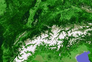
 MODIS NDVI 16 days composite
Fun section:
Affiliation
|
Markus Neteler, PhD Fondazione Edmund Mach - Research and Innovation Centre Via E. Mach, 1 - 38010 S. Michele all'Adige (TN) Italy http://www.fmach.it http://gis.cri.fmach.it/ markus.neteler AT fmach.it | neteler AT gmail.com |
 /"\    ASCII Ribbon Campaign
 \ /    Respect for low technology.
  X     Keep e-mail messages readable by any computer system.
 / \    Keep it ASCII.